- Home
- Quintessential Queensland
- Distinctiveness
- Perceptions
- Perceptions: how people understand the landscape
- From runs to closer settlement
- Geological survey of Queensland
- Mapping a new colony, 1860-80
- Mapping the Torres Strait: from TI to Magani Malu and Zenadh Kes
- Order in Paradise: a colonial gold field
- Queensland atlas, 1865
- Queensland mapping since 1900
- Queensland: the slogan state
- Rainforests of North Queensland
- Walkabout
- Queenslanders
- Queenslanders: people in the landscape
- Aboriginal heroes: episodes in the colonial landscape
- Australian South Sea Islanders
- Cane fields and solidarity in the multiethnic north
- Chinatowns
- Colonial immigration to Queensland
- Greek Cafés in the landscape of Queensland
- Hispanics and human rights in Queensland’s public spaces
- Italians in north Queensland
- Lebanese in rural Queensland
- Queensland clothing
- Queensland for ‘the best kind of population, primary producers’
- Too remote, too primitive and too expensive: Scandinavian settlers in colonial Queensland
- Distance
- Movement
- Movement: how people move through the landscape
- Air travel in Queensland
- Bicycling through Brisbane, 1896
- Cobb & Co
- Journey to Hayman Island, 1938
- Law and story-strings
- Mobile kids: children’s explorations of Cherbourg
- Movable heritage of North Queensland
- Passages to India: military linkages with Queensland
- The Queen in Queensland, 1954
- Transient Chinese in colonial Queensland
- Travelling times by rail
- Pathways
- Pathways: how things move through the landscape and where they are made
- Aboriginal dreaming paths and trading ways
- Chinese traders in the nineteenth century
- Introducing the cane toad
- Pituri bag
- Press and the media
- Radio in Queensland
- Red Cross Society and World War I in Queensland
- The telephone in Queensland
- Where did the trams go?
- ‘A little bit of love for me and a murder for my old man’: the Queensland Bush Book Club
- Movement
- Division
- Separation
- Separation: divisions in the landscape
- Asylums in the landscape
- Brisbane River
- Changing landscape of radicalism
- Civil government boundaries
- Convict Brisbane
- Dividing Queensland - Pauline Hanson’s One Nation Party
- High water mark: the shifting electoral landscape 2001-12
- Hospitals in the landscape
- Indigenous health
- Palm Island
- Secession movements
- Separate spheres: gender and dress codes
- Separating land, separating culture
- Stone walls do a prison make: law on the landscape
- The 1967 Referendum – the State comes together?
- Utopian communities
- Whiteness in the tropics
- Conflict
- Conflict: how people contest the landscape
- A tale of two elections – One Nation and political protest
- Battle of Brisbane – Australian masculinity under threat
- Dangerous spaces - youth politics in Brisbane, 1960s-70s
- Fortress Queensland 1942-45
- Grassy hills: colonial defence and coastal forts
- Great Shearers’ Strike of 1891
- Iwasaki project
- Johannes Bjelke-Petersen: straddling a barbed wire fence
- Mount Etna: Queensland's longest environmental conflict
- Native Police
- Skyrail Cairns (Research notes)
- Staunch but conservative – the trade union movement in Rockhampton
- The Chinese question
- Thomas Wentworth Wills and Cullin-la-ringo Station
- Separation
- Dreaming
- Imagination
- Imagination: how people have imagined Queensland
- Brisbane River and Moreton Bay: Thomas Welsby
- Changing views of the Glasshouse Mountains
- Imagining Queensland in film and television production
- Jacaranda
- Literary mapping of Brisbane in the 1990s
- Looking at Mount Coot-tha
- Mapping the Macqueen farm
- Mapping the mythic: Hugh Sawrey's ‘outback’
- People’s Republic of Woodford
- Poinsettia city: Brisbane’s flower
- The Pineapple Girl
- The writers of Tamborine Mountain
- Vance and Nettie Palmer
- Memory
- Memory: how people remember the landscape
- Anna Wickham: the memory of a moment
- Berajondo and Mill Point: remembering place and landscape
- Cemeteries in the landscape
- Landscapes of memory: Tjapukai Dance Theatre and Laura Festival
- Monuments and memory: T.J. Byrnes and T.J. Ryan
- Out where the dead towns lie
- Queensland in miniature: the Brisbane Exhibition
- Roadside ++++ memorials
- Shipwrecks as graves
- The Dame in the tropics: Nellie Melba
- Tinnenburra
- Vanished heritage
- War memorials
- Curiosity
- Curiosity: knowledge through the landscape
- A playground for science: Great Barrier Reef
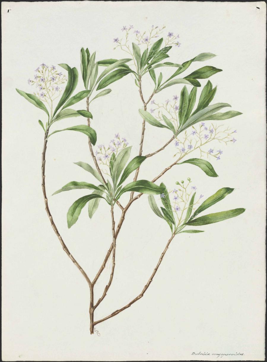
- Duboisia hopwoodii: a colonial curiosity
- Great Artesian Basin: water from deeper down
- In search of Landsborough
- James Cook’s hundred days in Queensland
- Mutual curiosity – Aboriginal people and explorers
- Queensland Acclimatisation Society
- Queensland’s own sea monster: a curious tale of loss and regret
- St Lucia: degrees of landscape
- Townsville’s Mount St John Zoo
- Imagination
- Development
- Exploitation
- Transformation
- Transformation: how the landscape has changed and been modified
- Cultivation
- Empire and agribusiness: the Australian Mercantile Land and Finance Company
- Gold
- Kill, cure, or strangle: Atherton Tablelands
- National parks in Queensland
- Pastoralism 1860s–1915
- Prickly pear
- Repurchasing estates: the transformation of Durundur
- Soil
- Sugar
- Sunshine Coast
- The Brigalow
- Walter Reid Cultural Centre, Rockhampton: back again
- Survival
- Survival: how the landscape impacts on people
- Brisbane floods: 1893 to the summer of sorrow
- City of the Damned: how the media embraced the Brisbane floods
- Depression era
- Did Clem Jones save Brisbane from flood?
- Droughts and floods and rail
- Missions and reserves
- Queensland British Food Corporation
- Rockhampton’s great flood of 1918
- Station homesteads
- Tropical cyclones
- Wreck of the Quetta
- Pleasure
- Pleasure: how people enjoy the landscape
- Bushwalking in Queensland
- Cherbourg that’s my home: celebrating landscape through song
- Creating rural attractions
- Festivals
- Queer pleasure: masculinity, male homosexuality and public space
- Railway refreshment rooms
- Regional cinema
- Schoolies week: a festival of misrule
- The sporting landscape
- Visiting the Great Barrier Reef
By:
Dale Kerwin An important aspect of a distinct Aboriginal culture derives from the tradition of travel, and the tangible and intangible goods that were traded along communication routes that criss-crossed Australia. The external and internal trade of cultural products generated knowledge of other societies, and impacted on societies that traded. The movement of these tangible objects, and the movement of material culture, resulted in expert mapping and familiarity with the dispersion paths taken by Aboriginal travellers. In this movement coastal estuaries, river systems, and catchment areas played a major role in assisting Aboriginal travellers to move deep into the very heart of Australia. These paths were also later followed by European surveyors and stockmen.
The dreaming paths of Aboriginal nations across Australia formed major ceremonial routes along which goods and knowledge flowed. These became the trade routes that criss-crossed Australia and transported religion and cultural values. Aboriginal roads assisted the European colonisation of Australia by appropriating Aboriginal competence in terms of the landscape: by tapping into culinary and medicinal knowledge, water and resource knowledge, hunting, food collecting and path-finding. As a consequence of this assistance, Aboriginal dreaming paths and trading ways also became the routes and roads of colonisers.
Trading was a time for sharing
Murrandoo Yanner, an Aboriginal leader from the Ganggalida nation, Mungubie (Burketown) North Queensland, talked in a personal communication in 1994 about the tradition and history of trading:
We had our domestic trade routes that went north, south, east and west, my people the Ganggalida traded for oysters, sea turtle and dugong from the north and in return we had goanna and turkey. We went to Normanton for gidgee lancewood and heavy wood for spears and clap sticks, we went west to Garawa for spear flints and stuff. We went south to the Waanyi and we also traded for a stone axe from the Kalkadoons.
We never just traded for goods, trading was a time for sharing of ideas and technology such as the woomera and outrigger canoes with sails. The didgeridoo started in a small place in Arnhem Land and by the time whites arrived it had spread over half the distance of Australia. There was also a lot of ceremony sharing, of food, of stories, of culture and time together. Trade was a time of catching up both pleasure and business. My mob when travelling would grind up the Mitchell grass and make Johnny cakes out of it.
Stone axes from the Mount Isa area found their way to areas along the eastern coast. In addition, the engraved pearl shells from the Dampier Peninsula, north-western Australia, actually reached the shores of the Great Australian Bight over 3200 kilometres, and the oval baler-shell ornaments from Cape York, north-eastern Australia.
Pituri road
One of the most important Aboriginal Highways is the ‘Pituri Road’. According to Pamela Watson’s 1983 monograph on the production, distribution and consumption of pituri, the Pituri Road ‘encompassed a river system where the headwaters of numerous streams [flowed] north into the Gulf of Carpentaria’. These streams also lie close to the catchment area for the Channel Country, where the tributaries of the southward-flowing waters of the Diamantina and Georgina Rivers flow. The Diamantina and Georgina Rivers form the floodplains of the Channel Country and the Lake Eyre basin. In this area the Finke and other river systems flow south into South Australia and Central Australia. According to Watson, the direction of the water formed the main trunk route for trade also flowed along other numerous river systems branching out from the main trunk. The Pituri Road brought together ‘religious and social institutions and inventors of technique’.
Pituri was also traded along these same story chains into Western Australia. The material was moved along the Two Dogs’ Dreaming story, which formed a major trading route.
Cohesive knowledge network
To provide a better understanding of the many devices used by Aboriginal people to move over the country, knowledge is required of tangible objects like the shield. Some of these objects are sacred while others are commonplace, everyday objects. The landscape, knowledge, story, song, graphic representation, and social relations all mutually interact, forming, according to David Turnbull in 1989, one ‘cohesive knowledge network’ to create way-finding devices.
Sandstone grinding dishes quarried at a site near Stuart Creek, south of Lake Eyre, were also taken north into Bedourie. Material culture of high economic significance was moved from one Aboriginal nation to another stage by stage. This may have taken years; and the value of the object increased as it got further from its point of origin. These items were moved along a major communication route from the west of the Flinders Ranges in South Australia and north to the Gulf of Carpentaria in Queensland. The latter route also linked with the route across Mount Isa to Cloncurry. Material culture that travelled up from the Flinders Ranges was red ochre, fine sandstone grinding dishes, and pituri. Material culture traded south from Cloncurry and the Gulf of Carpentaria included baler shell, stone axes, and pituri (the latter being the major commodity). The trading parties undertook major trading expeditions to the Flinders Ranges for red ochre and to Madlhu for pituri. These parties would travel several hundred kilometres, while others would possibly travel over 1000 kilometres.
Simpson Desert
The Simpson Desert was the hub of a major trading route along which goods travelled in all directions. It was a meeting place and a major trading centre for pituri. Tangible cultural material property as well as intangible cultural knowledge passed through the region. One such road that ran from Pituri Creek, on the Northern Territory and Queensland border, to Rockhampton is over 1600 kilometres long. Just outside of Rockhampton at the Carnarvon Ranges, baler shell stencils can be found. At the source of one pituri plantation at Woodnunajilla waterhole (Apwertetywernkwerre) (known as Salt Lake and related to the Snake Dreaming in Arrernte country), Urtneye was harvested and taken to Lake Caroline, where many groups would travel to trade for the tobacco. A.W. Howitt, W.E. Roth and pastoralist Lee Reese, have all noted the great distances that pituri trading took place – such as the 1600 kilometres Pituri Creek to Rockhampton route. Anne McConnell noted in 1976 that Boulia, Goyders Lagoon, and Kopperamanna also served as pituri trade centres.
The Aboriginal dreaming paths across Australia formed major ceremonial routes along which goods and knowledge flowed. Indeed, the European colonisation of Australia owes much of its success to the deliberate process of Aboriginal land management practices.
References and Further reading (Note):
Pamela Watson, This precious foliage: a study of the Aboriginal psycho-active drug Pituri, Sydney, University of Sydney, 1983
References and Further reading (Note):
Colin Bourke, Colin Johnson, and Isobel White, Before the invasion: Aboriginal life to 1788, Melbourne, Oxford University Press, 1980
References and Further reading (Note):
David Turnbull, Maps are territories, science is an atlas: portfolio of exhibits, Geelong, Deakin University Press, 1989
References and Further reading (Note):
Anne McConnell, ‘Aboriginal Trade in Australia’, MA thesis Australian National University, 1976
References and Further reading (Note):
Queensland Land Tribunal, ‘Aboriginal Land Claim to Simpson Desert National Park’, Report, Queensland Minister for Lands, 1994